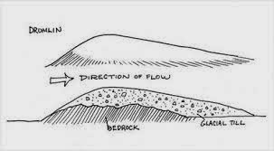
At the end of the Pleistocene (14,000 years ago)
glaciers began to recede, with the melt and reduction of glaciers
resulted in the loss and deposition of debris that had accumulated in the
glacier and carried materials over very large distances. Leaving behind eskers,
till, erratic’s as well as a very common mineral found in Northern Wisconsin,
which happens to be part of what geologist call the Miller Creek Formation,
this sediment was deposited at the end of our last glacial period. The reason
we bring this up is because clay is a mineral that is not porous, when clay
gets wet and compacted it creates tighter bonds with other clay minerals. When
we in Superior receive high amounts of precipitation, especially during the
spring when the ground is already saturated, these minerals cling together and
form a sheet like structure in which water easily flows over.
When looking at the lake the
boundaries of the lake are angled towards Superior. So during heavy rain
events, or those that happen while the ground is already saturated, direct
everything to the lake. With the accumulation of undesirable wastes in our
yards it is easy to see that it does not take much for water to run from our
properties, into the road, and into the lake. The material that makes up
Superior Wisconsin is not ideal for the natural filtration of rain water and
melt, for this reason it is important to clean up pet waste, reduce salt in the
winter and for you in the spring limit the amount of fertilizers used.
 |
| Remains of an esker often resembles an elongated hill formation |
You can see this at the Sea Caves near Cornicopia, WI, where
the till had been deposited on top of the sandstone formation. Red line
represents the extent of the sandstone formation and the area represented in blue
corresponds with glacial till.
Here is an example of an erratic, though sizes of these glacially dropped stones may vary, they were all deposited from the same processes
Written by Michael Krick.


No comments:
Post a Comment